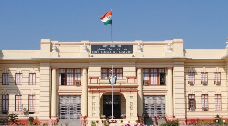
A complete ecosystem for UPSC Civils and State PSC Preparation

Districts Of Bihar - Part 1 | Polity of Bihar Notes

Districts Of Bihar – Part 1 notes/study material for preparation of BPSC Prelims and Mains and other Bihar state examinations

Districts Of Bihar - Part 1

Bihar is divided into 38 districts. Important information about the districts of Bihar is mentioned below.

Araria

  • Araria district was formed in January 1990.
  • Location → Located at the southern part of Purnia and Medhepura in Bihar. It Shares border with Nepal on the northern side.
  • Area → 1830 sq km
  • Population → 28,11,569
  • Literacy Rate → 53.53%
  • Blocks → 9
  • Major Tourist places → Raniganj Vriksh Vatika, Bio-Diversity Park, Kusiargaon
  • Araria largely has an agrarian economy. Paddy, Maize and Jute are the main crops.

Arwal

  • It came into existence in August 2001 as it was earlier part of Jehanabad district.
  • Location → Situated at 60 km south of Patna
  • Area → 634.23 sq km
  • Population → 700843
  • Literacy Rate → 67.43%
  • As per 2011 census, it is the third least populous district of Bihar.
  • Blocks → 5
  • Major Tourist places → Makhdum Shah Ka Mazaar, Aganur Jal Vidyut Pariyojna
  • Main River → Son 
  • Arwal largely has an agrarian economy. Paddy, wheat and maize are the main crops. 

Aurangabad

  • It was created on  26 January 1973.
  • Location → Situated on the Grand Trunk Road
  • Area → 3,305 sq km
  • Population → 2,540,073
  • Literacy Rate →70.32 %
  • Blocks → 11
  • Major Tourist places →  Deo Temple(Sun temple), Umga Temple
  • Aurangabad is also called “Chittorgarh” of Bihar.
  • It is the birthplace of eminent nationalist Bihar Vibhuti Dr. Anugrah Narayan Sinha.He was first Deputy Chief Minister of state.
  • In ancient times, Aurangabad was located in the Kingdom of Magadh.
  • Aurangabad largely has an agrarian economy. 

Banka

  • It was established on 21 February 1991.
  • Location → Shares border with the state of Jharkhand
  • Area →  3,020 sq km
  • Population → 2,034,763
  • Literacy Rate → 58.17  %
  • Blocks → 11
  • Sex Ratio → 907
  • Major Tourist places →  Mandar Hill where Samudra Manthan Occured occurred by Hindu rituals. 
  • Main River → Chanan, Barua
  • Banka has a largely agrarian economy.

Begusarai

  • Location →  Situated on the northern bank of the river Ganges in the Mithila region.
  • Area →  1918 sq km
  • Population → 2970541
  • Literacy Rate →   59.13%
  • Blocks → 18
  • Major Tourist places →   Jai Mangla Temple, Nauo Lakha Temple,
  • Main River → Ganga
  • It is named after Begu, a man who was the devotee of Bari Durga Maharani and was the caretaker of Sarai, the town’s old market.
  • Kanwar Lake Bird Sanctuary →  Located in Begusarai district of Bihar, It is Asia’s largest freshwater oxbow lake. In November 2020, the Ministry of Environment, Forest and Climate Change (MoEFCC) declared it the first Ramsar site in Bihar. As of 2024, there are total 85 Ramsar Sites in India 
  • Begusarai is famous for Simaria, a fair of devotional significance conducted every year usually during November.
  • Dhuno-Naach is the Cultural Dance of Begusarai which is performed during Durga Puja and Kalipuja.

Bhagalpur

  • Bhagalpur is historically also known as Champa Nagri.
  • Bhagalpur city is the administrative headquarters of this district.
  • Bhagalpur city is known as the Silk City.
  • Location → Located in the southern region of Bihar
  • Area →  2569 Sq Km
  • Population → 3,037,766
  • Blocks → 16
  • Major Tourist places →  Ruins of Vikramshila, Shri Champapur Digamber Jain Siddha Kshetra
  • Main River → Ganga
  • The primary language used in the district is Angika.
  • Vikramshila Gangetic Dolphin Sanctuary → Located in Bhagalpur District of Bihar, it is the protected area for the endangered Gangetic dolphins. It is to be noted here that The Gangetic Dolphin have been declared as the national aquatic animal of India,

Bhojpur

  • Bhojpur district came into existence in 1972. Before 1972, it was part of Shahabad district.
  • In 1972, Shahabad district was bifurcated in two Bhojpur and Rohtas districts.
  • Ara is the administrative headquarters of Bhojpur district.
  • Area →  2,395 Sq KM
  • Population → 2,720,155
  • Literacy Rate → 72.79%
  • Blocks → 14
  • Main River → The Ganges, Sone  
  • Considered as the best wheat-growing area in the state of Bihar .
  • Bhojpur is named after Raja Bhoja of Parmara dynasty  
  • Main language → Bhojpuri

Buxar

  • Buxar district was separated from Bhojpur district in March 1991.
  • Buxar is an historically important district as Battle of Buxar and Battle of Chausa were fought here.
  • Location → Located on the southwestern part of the state on the banks of river Ganges bordered by Rohtas and Kaimur districts in south, and by Bhojpur district in the east. 
  • The Ganga and Karmanasa Rivers form the boundary with the state of Uttar Pradesh. The river Karmansa joins the river Ganga near Chousa.
  • Agriculture is the main occupation. Major crops are rice, wheat, barley, and pulses. The river Sone and Ganga are the main source of irrigation.
  • Area: 1624 sq km
  • Population: 1706352
  • Literacy Rate: 70.14%
  • Block: 11
  • Sex Ratio → 922 
  • Major Tourist places →  Katkauli ka Maidan, Bihari Ji Temple, Chausa Battle Field
  • Main language → Bhojpuri

Darbhanga 

  • Location → Darbhanga is bordered on the north by Madhubani district, on the south by Samastipur district, on the east by Saharsa district and on the west by Sitamarhi and Muzaffarpur districts.
  • Area: 2279 Sq. Km.
  • Population: 3937385
  • Literacy Rate →  44 %
  • Sex Ratio → 910 
  • Blocks → 18
  • The district is important for its trade in Fish, Mango and Makhana.
  • Major Tourist places →  Ahilya Asthan, Maharaja Lakshmeshwar Singh Museum

East Champaran

  • Prior to 1971, there was a single Champaran District. On 1 December 1971, Champaran was divided into East and West Champaran (Purvi and Paschimi Champaran). 
  • The headquarters of the district is at Motihari. 
  • Location → It shares a border with Nepal on the northern side, Sitamarhi and Sheohar are in the east. Muzaffarpur in South and Gopalganj, West Champaran are on the western side.
  • Agriculture is the main occupation.
  • Area: 3,968 sq km
  • Population: 50,99,371
  • Literacy Rate: 55.79%
  • Block: 27
  • Sex Ratio → 902
  • As per 2011 census, it is the second most populous district of Bihar.
  • Major Tourist places →  Someshwar Nath Mandir, Ashokan Pillar in Lauria Nandangarh, Raxaul (Also known as Gateway to Nepal), Champaran Satyagrah Park, Kesaria Buddhist Stupa
  • Main River → Gandak, Burhi Gandak and Baghmati 

Polity of Bihar Question Bank

multiple choice questions with answer and explanation from BPSC Previous Year's Examinations.

You can study complete ancient history of Bihar in a chapterwise format here : Ancient History of Bihar Chapter-wise notes

You can study complete history of Bihar in a chapterwise format here : History of Bihar Chapter-wise notes

You can study complete study material for BPSC here : Complete BPSC free study material

You can study complete ancient history in a chapterwise format here : Ancient History Chapter-wise notes

You can solve ancient history chapterwise MCQs here : Ancient History Chapter-wise MCQs

You can read all the CivilsCracker Explained articles for Ancient History here :  CivilsCracker Explained

You can read all the UPSC free study materials for all subjects here : Free UPSC study materials for all subjects

You can solve chapterwise MCQs for all subjects here : Chapterwise MCQs for all subjects

Also Read in Polity of Bihar:

error: Content is protected !!