A complete ecosystem for UPSC Civils and State PSC Preparation

BPSC Indian Geography Question Bank

BPSC Indian Geography Question Bank of BPSC Previous Year’s Papers for preparation of BPSC Prelims and other Bihar state examinations.
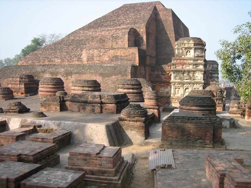
1. Area of India is 2.4% of the total area of the world but its (BPSC – 1994)

(a) Population is 16% of world population
(b) Population is 17% of world population
(c) Population is 18% of world population
(d) Population is 28% of world population

Correct Answer – (b) Population is 17% of world population

  • As per census 201, the area of India is 3287263 square km. which is approximately 2.4% of the total land area of the world, whereas its total population is 17.5% of the total population of the world.
  • India is seventh-largest in the world.

2. The expansion of India is between ? (BPSC – 1994)

(a) 37° 17′ North and 8º 06′ South
(b) 37° 17′ North and 8° 04′ South
(c) 37° 06’ North and 8º 04′ South
(d) None of the above

Correct Answer –  Ans. (d).

  • India lies between 8°4′ North to 37°6′ North latitudes.
  • It lies between 68° 7′ East to 97° 25′ East longitudes.

3. How much is the difference between Indian Standard Time (I.S.T.) and Greenwich Mean Time (G.M.T.) ? (BPSC – 2001)

(a) 4 hours 30 Minutes
(b) 5 hours 30 Minutes
(c) 3 hours 30 Minutes
(d) 4 hours 00 Minutes

Correct Answer – (b) 5 hours 30 Minutes

  • Indian Standard Time is calculated on the basis of 82.5°E longitude.
  • This Meridian passes through Naini, Allahabad in the state of Uttar Pradesh. 
  • The Indian Standard Time is ahead of Greenwich Mean Time by 5 hours and 30 minutes.
  • The meridian passes through the following states of India: 
    • Uttar Pradesh
    • Madhya Pradesh
    • Chhattisgarh 
    • Odisha
    • Andhra Pradesh.

4. The foothills region of Himalayas is called ? (BPSC – 1999).

(a) Trans-Himalayas
(b) Shiwalik
(c) Greater Himalayas
(d) Aravali

Correct Answer – (b) Shiwalik

  • The foothills region of Himalaya is called Shiwalik. These are the outermost range of the Himalayas. 
  • The Himalayas are divided into three primary ranges that extend from north to south:
    • Himadri/Greater Himalayas – The northernmost range which is home to most of the world’s tallest peaks which include Mount Everest and Kanchenjunga
    • Himachal/Lesser Himalaya –  Located south of Greater Himalayas, Home to many famous hill stations such as Shimla, Nainital, and Manali etc.
    • Siwaliks –  Southernmost range of Himalayas, Formed by sediments carried down by rivers from the northern Himalayan peaks.

5. Shiwaliks were formed in ? (BPSC – 1997)

(a) Eozoic
(c) Mesozoic
(b) Paleozoic
(d) Cenozoic

Correct Answer – (d) Cenozoic

  • Shiwaliks or outer Himalayas were formed approximately 5-1.7 million years ago in the Pliocene Era in Cenozoic period.

6. Which of the following hills are found where the Eastern Ghats and the Western Ghats meet ? (BPSC – 1999, 2016)

(a) Annamalai Hills
(b) Cardamom Hills
(c) Nilgiri Hills
(d) Shevaroy Hills

Correct Answer – (c) Nilgiri Hills

  • Nilgiri Hills are located at the junction of Western Ghats and Eastern Ghats.
  • Doddabetta is the highest mountain in the Nilgiri Hills having a height of 2,637 meters.

7. Western Ghats in Maharashtra and Karnataka is known as ? (BPSC – 2000)

(a) Nilgiri mountain
(b) Sahyadri
(c) Deccan plateau
(d) None of these


Correct Answer – (b) Sahyadri

  • Western Ghats is known as Sahyadri in Maharashtra, Goa & Karnataka. 
  • The Western Ghats has a high altitudinal variation and the average elevation is around 1200 meters.
  • The highest peak in the Western Ghats is Anamudi, which is located in Kerala.

8. Highest mountain peak located in India is ? (BPSC – 1997)

(a) Anamudi
(b) Kanchanjungha
(c) Nanda Devi
(d) Mount Everest

Correct Answer –  (b) Kanchanjungha

  • Kanchenjunga is a Himalayan mountain peak that lies between Sikkim, India, and Nepal. 
  • It is the third highest peak in the world with an elevation of 8,586 m. 
  • It is the highest peak in India.

9. Chotanagpur Plateau ? (BPSC – 1995)

(a) Is rich in minerals and coal
(b) Is a pitfall
(c) Is a foothill
(d) Is a fold mountain

Correct Answer –  (a) Is a front sloping

  • Chota Nagpur plateau is located mainly in Jharkhand as well as adjacent parts of Odisha, West Bengal. Bihar and Chhattisgarh.
  • The plateau is composed of Precambrian rocks.
  • Through its center, from west to east, lies the coal-bearing Damodar River valley.
  • The Chotanagpur Plateau consists of a series of plateaus at different levels of elevation.
  • The Chotanagpur Plateau is rich in minerals and coal.
  • The Damodar valley has vast coal reserves, and the Hazaribagh region is one of the main sources of mica in the world. 
  • Other minerals that are found here are copper, limestone, bauxite, iron ore, asbestos, and apatite.

10. Lakshadeep island is situated ? (BPSC – 1992)

(a) In South West India
(b) In South India
(c) In South East India
(d) In East India near West Bengal

Correct Answer –  (a) In South West India

  • Lakshadweep is a group of islands in the Arabian sea. 
  •  It is an archipelago of 36 islands.
  • These are scattered between 8ºN – 12°N and 71°E – 74°E. 
  • The largest island of Lakshadweep is Andrott.
  • Minicoy is the second largest island separated from other islands by the 9° Channel. 
  • Kavaratti is the capital of Lakshadweep.

11. Islands group Lakshadweep was formed by the ? (BPSC – 1994)

(a) Accumulation of coral reef
(b) Accumulation of volcano substances
(c) Soil sedimentation
(d) None of the above-mentioned is true

Correct Answer – (a) Accumulation of coral reef

  • Lakshadweep is a group of islands that was built mainly by coral deposits. 
  • Coral reefs are underwater ecosystems made up of colonies of corals that are held together by calcium carbonate. 
  • They are home to a large variety of marine life and are found in shallow waters around the world.
  • They are rich in biodiversity.

12. Vidarbha is a regional name in India and it is a part of ? (BPSC – 1996)

(a) Gujrat
(b) Maharashtra
(c) Madhya Pradesh
(d) Orissa

Correct Answer – (b) Maharashtra

  • Vidarbha is north-eastern region of the State of Maharashtra.
  • This region comprises Nagpur, Amravati, Chandrapur, Akola, Vardha, Buldhana, Yavatmal, Bhandara, Gondia, Washim and Gadchiroli district of Maharashtra.

13. The Pat region is located in ? (BPSC – 2000)

(a) Bihar
(b) Jharkhand
(c) Madhya Pradesh
(d) Meghalaya

Correct Answer – (b) Jharkhand

  • ‘Pat Region’ is located in Chota Nagpur region. 
  • It is a flat-topped plateau with an average elevation of 1,000 meters above sea level. 
  • It is made up of many sub-plateaus sometimes having small peaks in between which are known as pats or patlands.
  • Maximum part of Chota Nagpur plateau lies in the State of Jharkhand.

14. The three largest States of India in order of area are ? (BPSC – 2011)

(a) Rajasthan, Madhya Pradesh, Maharashtra
(b) Madhya Pradesh, Rajasthan, Maharashtra
(c) Maharashtra, Rajasthan, Madhya Pradesh
(d) Madhya Pradesh, Maharashtra, Rajasthan

Correct Answer – (a) Rajasthan, Madhya Pradesh, Maharashtra

  • Total area of India is 3,287,263 sq. km. which is 2.4% of the total area of the world.
  • The largest States of India in order of area are:
    • Rajasthan (3,42, 239 sq. km) 
    • Madhya Pradesh (3,08,252 sq. km)
    • Maharashtra (3,07,713 sq. km )

15. Manas is the tributary of which among the following rivers ? (BPSC – 2000)

(a) Godavari
(c) Krishna
(b) Mahanadi
(d) Brahamputra

Correct Answer – (d) Brahamputra

  • The Manas River is a tributary of the Brahmaputra River.
  • It is the largest right bank tributary of Brahmaputra.

16. In India, the third largest state according to population is ? (BPSC – 2008)

(a) Maharashtra
(b) Madhya Pradesh
(c) Karnataka
(d) Bihar

Correct Answer – (d) Bihar

  • Bihar is the 3rd largest State of India by population. 
  • As per 2011 census,  Its population is 104,099,452.

17. Consider the following statements : (BPSC – 2001)

1. Capital of Gujrat is Gandhinagar.
2. Capital of Rajasthan is Jaipur.

Select the correct answer using the codes given below:

(a) 1 only
(b) 2 only
(c) Both 1 & 2
(d) None of the above

Correct Answer – (c) Both 1 & 2

  • Gandhinagar is the capital of the state of Gujarat.
  • Capital city of Rajasthan in Jaipur.
  • Jaipur is also known as Pink City.

18. The Dravidian races are mainly confirmed at which of the following parts of India ? (BPSC – 2016)

(a) South India
(b) North-Western India
(c) North-Eastern India
(d) North India
(e) None of the above/More than one of the above

Correct Answer(a) South India

  • The Dravidian races are mainly confined to South India. 
  • This race is related to the Dravidian language family that includes Tamil, Kannad, Malayalam, Telugu etc. 
  • It is to be noted here that the idea of a Dravidian race was created by the British as part of their divide-and-rule policy in India. According to many scholars, Dravidian is just a geographical division, not racial difference.

19. Which amongst the following states has no identified tribal communities ? (BPSC – 2015)

(a) Maharashtra
(b) Chhattisgarh
(c) Haryana
(d) Karnataka

Correct Answer(c) Haryana

  • Among the given options, Haryana has no identified tribal communities. 
  • According to the 2011 census, 8.6% of the total population of India are tribal communities with the maximum population concentrated in the states of Madhya Pradesh, Maharashtra and Odisha.

20. Gaddis are inhabitants of ? (BPSC – 2000)

(a) Madhya Pradesh
(b) Himachal Pradesh
(c) Arunachal Pradesh
(d) Meghalaya

Correct Answer(b) Himachal Pradesh

  • People belonging to Gaddi tribe are mostly found in Kangra and Chamba districts of Himachal Pradesh. 
  • They stay in the foothills of Dhauladhar Range(Western Himalayas).

21. Bodos are inhabitants of ? (BPSC – 1994)

(a) Garo hills
(b) Santhal Pargana
(c) Amazon Basin
(d) Madhya Pradesh

Correct Answer –  (a) Garo hills

  • Bodos are an ethnic and linguistic group which mainly resides in Garo hill of Meghalaya. 
  • They speak Tibeto-Burman languages.
  • They are also the largest minority group in Assam.

22. Where is the Bhil Tribe found ? (BPSC – 2008).

(a) Assam
(b) Jharkhand
(c) West Bengal
(d) Maharashtra

Correct Answer(d) Maharashtra

  • People of Bhil Tribe are mostly found in States like Madhya Pradesh, Maharashtra, Gujrat, Chhattisgarh and Rajasthan.
  • Famous Ghoomar dance is a traditional folk dance of Bhil Tribe in Rajasthan.

23. In India, ‘Yarlung Zangbo River’ is known as ? (BPSC – 2015)

(a) Ganga
(b) Indus
(c) Brahmaputra
(d) Mahanadi

Correct Answer –  (c) Brahmaputra

  • Yarlung Zangbo is known as Brahmaputra river in India. 
  • It originates near lake Mansarovar.

24. Mansarovar lake in Tibet is the source of which among the following rivers ?

(a) Brahmaputra
(c) Indus
(b) Satluj
(d) All the above

Correct Answer –  (d) All the above

  • The source of river Brahmaputra, Indus and Sutlej, is near Mansarovar Lake in Tibet.

25. At which of the following towns the Alaknanda and the Bhagirathi combine to form Ríver Ganga ? (BPSC -2016)

(a) Haridwar
(b) Rishikesh
(c) Rudraprayag
(d) Devprayag
(e) None of the above/More than one of the above

Correct Answer(d) Devprayag

  • The Panch Prayag are located in the Garhwal region of Uttarakhand.
  • They are located at the confluence of different rivers.
  • They are:
    • Vishnuprayag – Confluence of Alaknanda River and Dhauliganga River
    • Nandaprayag – Confluence of Alaknanda and Nandakini rivers
    • Karnaprayag – Confluence of Alaknanda and Pindar rivers 
    • Rudraprayag – Confluence of Alaknanda and Mandakini rivers 
    • Devprayag – Confluence of Alaknanda and Bhagirathi rivers

26. The longest flowing river in India is ? (BPSC – 1995)

(a) Mahanadi
(b) Godawari
(c) Ganga
(d) Narmada

Correct Answer –  (c) Ganga

  • Ganga river is the longest flowing river in India.
  • Length of the rivers mentioned in the option are given below:
    • Ganga river – 2525 kms
    • Godavari river – 1465 kms
    • Narmada river – 1312 kms
    • Mahanadi river – 858 kms

27. The river which flows through a fault is ? (BPSC – 2000)

(a) Narmada
(b) Brahmaputra
(c) Ganga
(d) Krishna

Correct Answer (a) Narmada

  • Originating at the Amarkantak Hill, Narmada river flows westwards and passes through a rift valley between Vindhya and Satpura ranges.
  • It falls into the Gulf of Cambay into the Arabian Sea. 
  • Another west flowing peninsular river is Tapti. It originates in Betul district of Madhya Pradesh, passes through a rift valley and falls into the Arabian Sea.

Also Read in BPSC Question Bank:

error: Content is protected !!